Create Map node
The Create Map node creates a map holding height, orientation and offset information used to combine simple materials.
Inputs
The Create Map node accepts two inputs:
the height component as a grayscale image.
an optional offset map.
Outputs
The Create Map node outputs the map in an RGB image where:
the red component holds the height information
the green component holds the orientation information
the blue component holds the offset information
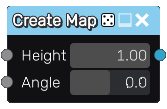
Parameters
The Create Map node has two parameters:
height is the maximum height of the map
angle is the orientation of the map